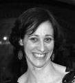
Sarah Mubareka

Sarah Mubareka is a scientific officer and project leader in the Forests and Bioeconomy Unit of the Joint Research Center, collaborating in a team of experts whose focus is on the sustainability of the EU bioeconomy. This includes aspects of forestry and forest-based bioeconomy supply chains, as well as more general questions in sustainability science. Her research interests are in system's level assessments of cross cutting bioeconomy-related policies, biomass supply chains (including trade) and cascade use of wood, and in environmental impacts of policy with focus on land use intensity and land cover in Europe. Her team develops methods, including free and often open-source tools, for environmental sustainability assessments with a focus on forestry and the forest sector. She has a Ph.D. in Remote Sensing and Environmental Science from the University of Sherbrooke (Quebec, Canada) and has been working with the European Commission’s Joint Research Centre under various capacities since 2000.

